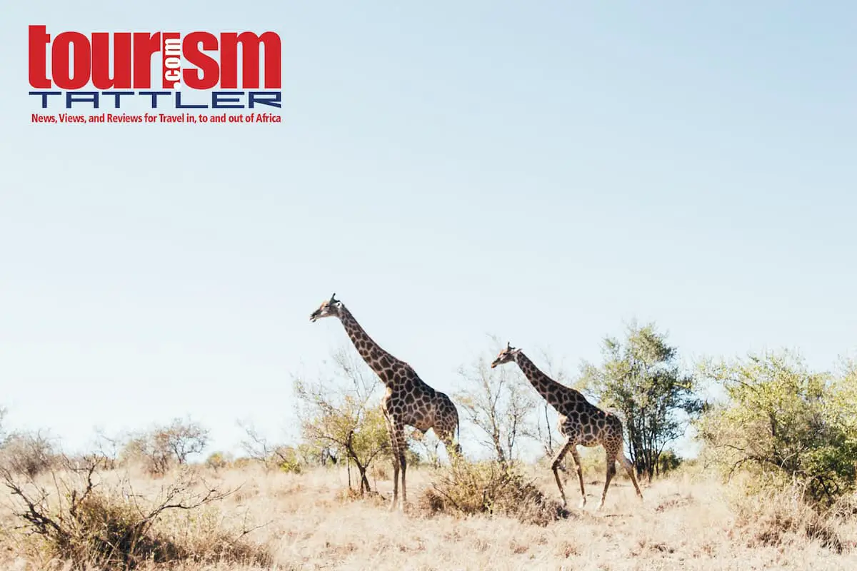
If unusual destinations and unique experiences are attributes that differentiate tour operator and travel agent success, then the Cape Whale Coast region of South Africa’s Western Cape province should be included as it possesses both in abundance.
As a publisher and travel writer, I’ve visited Cape Town and its wine regions on many occasions but have never ventured beyond the Kogelberg mountains and over Sir Lowry’s Pass to explore the Western Cape province of South Africa’s Overberg region (the name translated from Afrikaans, literally means ‘the other side of the mountain’). Until now, that is!
In this article, I will focus on a general overview of the Overstrand region, as the coastal towns of the Cape Whale Coast are where the majority of tourists flock. To keep this article brief, I have included hyper-links for further reading on attractions or places of interest.
Due to Overstrand’s close proximity to Cape Town (an hour’s drive East of the International airport, along the N2 freeway through Somerset West, over Sir Lowry’s Pass and take the Hermanus / Botrivier off-ramp) many of the towns are holiday resorts. The municipal area of Overstrand is huge, covering a surface of almost 1708 square kilometres, which stretches along the Atlantic seaboard from Betty’s Bay in the East to Gansbaai in the West, and has four tourist information centres located in Kleinmond, Hermanus, Stanford and Gansbaai. The largest town is Hermanus, which is situated on the northern edge of Walker Bay next to the Klein River mouth.
Clarence Drive
Opting for the more scenic drive from Cape Town (along the N2 and turn right at the Gordon’s Bay / Kleinmond sign and left at the T-junction in Gordon’s Bay, onto the R44), Clarence Drive is a coastal road carved from rocky sea cliffs, which in my opinion rivals Cape Town’s Chapman’s Peak Drive between Noordhoek and Hout Bay in terms of scenic beauty (and without any toll fees).
Clarence Drive provides magnificent views across False Bay to Table Mountain and the Cape Peninsula. Although Clarence Drive is rather steep, there are ample lay-by view points (sufficiently wide enough for tour coaches), which provide tourists with ideal photo opportunities and an ideal introduction to the region en route to their accommodation.
Clarence Drive leads through the Kogelberg Biosphere, the first and only Biosphere in South Africa to be proclaimed by the United Nations’ Educational, Scientific and Cultural Organisation (UNESCO): a testament to the stunning diversity and large number of its flowering plants, many of which are found nowhere else in the fynbos biome. The reserve boasts more than 1,880 different plant species, of which seventy seven species occur nowhere else on earth (the next richest is the South American rainforest with just 420 species per 10,000 square kilometres).
The Drive leads to Kogel Bay – a surfers paradise with barrel breaks curling along an expansive stretch of white beach, favoured by topless sunbathers for its sheltered cove and protection from occasional southeaster wind.
Rooiels to Kleinmond
Rooiels is the next attraction along the Cape Whale Coast route – a small seaside village and a favourite spot for family outings on the beach. Five kilometres on is Pringle Bay, with quaint holiday homes along the shoreline and a few restaurants for light lunches. Hangklip (‘hanging rock’ literally named after the draping rock-face that appears to cling to the mountainside) appears to the right of a sharp bend in the road and forms the entrance to False Bay with its 22 meter lighthouse tower that has kept sailors, seafarers and fisherman safe since 1960.
Driving another ten kilometres reveals Betty’s Bay – once the site of a whaling station and home to one of only two mainland Jackass Penguin Colonies in South Africa (the other is Boulder’s Beach – in Simon’s Town, which forms part of the Table Mountain National Park Marine Protected Area). The Harold Porter National Botanical Garden is well worth a visit and is located within the Kogelberg Biosphere Reserve. The nominal entrance fee (see link for rates) is worth the privilege of experiencing the garden trails, and guided group tours can be arranged by booking at least two weeks in advance.
Kleinmond, at the foot of the Palmietberg, is the next town and the Hangklip-Kleinmond Tourism Bureau is located in the Protea Centre on the left of Main Road – worth a brief stop-over to collect product brochures and view their display of local artefacts and fynbos plant samples. The Kleinmond new harbour area is also worth a visit, where your clients can buy honey, biltong, dried fynbos flowers, arts & crafts or enjoy fresh oysters and line-fish at any of the several restaurants.
Organised annual events along the Hangklip-Kleinmond route include the Totalsports Challenge (a seven discipline sporting event) in January, the Big Blues Music Festival in March, the African X Trail (trail running) in April, the Gravity Adventure Festival in August, the Windgat Festival (enviro family event) in September, and the Hot Heels Africa (downhill skateboarding) event in December.
From Kleinmond, the R44 road leads past the Botrivier Estuary and ends in a T-junction on the R43, where one can either to turn right towards Hermanus and the Whale Route, or turn left to explore the Elgin Valley and Overberg countryside along the N2 towards George and the Garden Route.
Fisherhaven to Hermanus
Opting for the right turn, the pristine Onrus Mountain Conservancy flanks the left side of the road as one passes by the seaside resort of Fisherhaven with its lagoon, yacht club, public slipway and playground, and a herd of wild horses that have adapted to a diet of slightly saline water and plants (It is interesting to note that during World War II, the Royal Air Force Squadron 262 established a diversion base at the lagoon and Consolidated PBY Catalina flying boats operated from here).
You will the drive past Hawston, which boasts an immaculate Blue Flag beach, and the village of Vermont with its luxurious homes nestled amongst the fynbos or overlooking the rocky coastline. Onrus is the next village, which means ‘restless’ in Afrikaans, referring to the pounding of the surf on the rocky coast. It is a predominantly residential area close to the coastline, as is Sandbaai (Sand Bay), which neighbours Onrusrivier and shares a popular swimming beach.
Proceeding along the R43 (note the speed restriction signs), a sign posted turn-off on the left to Rotary Way leads to the top of the mountain range, giving the viewer an elevated panoramic photo opportunity of this pristine area.
Back onto the R43, the New and Old Harbour turn-off appears on the right. The Old Harbour Museum is well worth a visit. The museum comprises two sections: the Historical Old Fishing Harbour and the Fisherman’s Village that displays boats, the old sea wall, brine tanks and ‘bokkom’ (salted fish) stands. The indoor museum houses a photographic exhibition of Old Hermanus, which dates back as far as the end of the 19th Century and beginning of the 20th.
Continuing along the R43, the road leads into Hermanus (originally called Hermanuspietersfontein, but shortened as the name was too long for the postal service), which is the commercial hub of the Overstrand and is famous for southern right whale watching during winter and spring (June to September) – hence the Overstrand’s marketing slogan: ’The Whale Coast’. Whales were once hunted in Betty’s Bay, but are now protected to ensure the survival of the species. The Old Harbour Museum contains several exhibitions that explain the whaling industry, and the De Wetshuis Photo Museum houses an exhibition of photos that depict the history of Hermanus. The Whale Museum houses a skeleton of a whale and shows an audio-visual presentation of whales and dolphins twice daily.
Hermanus has what is believed to be the world’s only Whale Crier, whose job is to blow his kelp horn thus announcing where whales have been spotted. His calls can also be heard during tours, as the group visit several of the more well known areas for whale watching and are told the related history of Hermanus. The current Whale Crier is Eric Davalah, who out of season can be found at either the Information Kiosk at the Village Square or at the Hermanus Tourism Bureau in Mitchell Street.
Besides it’s reputation as a whale watching destination, Hermanus is also one of the few municipalities that taken accessible tourism seriously by providing demarcated areas with ‘Disabled Friendly’ logo signage. Bathrooms for disabled visitors can be found at the Market Square and Municipal Library, whilst recreational facilities where the disabled can be accommodated are at the Village Craft Market, Fernkloof Nature Reserve, certain parts of the Cliff Paths, Voëlklip beach, the Public Library, the Cliff Top Development and Grotto Beach. Note: for helpful hints on catering to the needs of disabled tourists, read the QASA ‘Sawubona Disability’ booklet for Myths, Manners, Do’s & Don’ts about Disability.
Popular attractions in Hermanus include the 1800 hectare Fernkloof Nature Reserve, the Hemel-en-Aarde Valley – a 6.7 kilometre Wine Route along the R320 to Caledon, Gearing’s Point and the Cliff paths, which offer one of the best locations for whale spotting and watching, and the Blue Flag Grotto Beach, which stretches for almost 18 kilometres, fronting the Klein River lagoon and Walker Bay Nature Reserve, and has two beach-friendly wheelchairs in place for those with physical disabilities to access the sea.
Hermanus is also home to SANSA Space Science, formerly known as the Hermanus Magnetic Observatory. SANSA Space Science is the warning centre for Africa, one of thirteen regional warning centres around the world, which monitor extreme space weather and solar magnetic activity.
Annual events in Hermanus include the FynArts Festival (June), the Kalfiefees and Food and Wine Festival (Hermanuspietersfontein) in August, the Whale Festival and the Flower Festival (BOTSOC) in September.
Stanford to Gansbaai
Driving through Hermanus along the R43, the village of Stanford lies inland, about a 20 minute drive from Hermanus. This quaint historic village is ideal for day trippers looking for antique stores, restaurants, vineyards, coffee shops or a picnic in the country. Stanford is fast becoming a food destination with chefs serving an array of fresh and locally produced food with a leaning towards the slow food movement. Foods range from family fare, gourmet delights, country comfort cuisine, pub grub to fine dining.
Continuing along the R43, the Grootbos Nature Reserve rises against fynbos clad hills above Walker Bay with breathtaking views of dunes, sea and the distant Cape of Good Hope. Within this eco-paradise, lies the Grootbos Private Nature Reserve with two 5-Star luxury lodges, a Villa, consisting of six elegant suites accommodating up to 12 guests, and two fully equipped spa facilities.
De Kelders (‘The Caves’ in Afrikaans) is the next turn-off. De Kelders is a residential area and in spite of its reputation as a premium whale watching site, it has been immune to large scale tourism developments. There is a restaurant, bakery and pub in De Kelders as well as a coffee shop overlooking the bay. De Kelders has several guesthouses and B&B’s of which many are situated right on the cliffs overlooking the ocean.
Gansbaai is the next town along this stretch of the Cape Whale Coast. The town of Gansbaai is the business hub of the area, with a number of restaurants and a commercial fishing harbour. The Danger Point Lighthouse is situated on the Gansbaai peninsula , which is a rock reef that extends for about 8km out to sea. A hidden rock lurks just below the surface off the Point, and it is this rock that the legendary HMS Birkenhead collided with and sank in 1852. Seven shipwrecks surround Danger Point and 140 wrecks are dotted along the shores between Danger Point and Cape Infanta.
Blompark is located in the heart of the Gansbaai area, surrounded by fynbos vegetation and only a short walk on the gravel road to Romansbaai, traditionally the beach for the people of Blompark. Many of the inhabitants of Blompark are descendants of the earliest residents of the Gansbaai area. Up to 40 years ago, the community now living in Blompark had their traditional home more or less immediately on the doorstep of Romansbaai, next to the old municipal stores, called the “Old Location”. Today the Blompark people call their former home the “Nets Court” to pay tribute to the fishing tradition that was established there.
Kleinbaai, on the eastern side of Gansbaai is the launch site for white shark cage diving, which takes between 3-5 hours, depending on the weather, sea conditions and shark behaviour. Trips depart from Kleinbaai harbour and the anchor site depends on the sea conditions, weather and previous shark sightings. Tourists wishing to cage dive do not have to be scuba qualified. Weather permitting, White Shark cage diving and sightseeing tours run daily, however prime viewing time is in the South African winter months when the sharks have a particularly active feeding pattern.
The following guide is based on observations by White Shark Projects over the past eight years. Allow for an overlap between seasons:
• Peak season: April to October (99% success rate).
• High season: November to December (90 – 99% success rate).
• Intermediate season: January to March (80 – 90% success rate).
Water temperatures vary between 12 and 20 degrees Celsius during peak and high season and between 10 and 16 degrees Celsius during intermediate season.
Dyer Island, located a few kilometres south of Gansbaai, is a protected bird sanctuary and used to house a large colony of African Penguins – about 25 000 pairs. Today, there are only about 900 penguin pairs left due to human interference. This small, twenty hectare island is the easternmost of the chain of seabird islands off the Western Cape. Rare, endangered bird species such as the Roseate Tern and the Leach’s Storm Petrel still breed on the island, as well as seabirds such as the Whitebreasted, Cape, Bank and Crowned Cormorants, Kelp Gulls and Hartlaub’s Gulls, and Swift Terns. Huge roosts of terns, mainly the migratory Common and Sandwich Terns, occur in summer. Antarctic Terns, which breed on the sub-antarctic islands, roost here in winter.
Dyer Island is a nature reserve managed by CapeNature, but has no visitor access facilities. This is understandable both in terms of the sensitivity of the island’s birds to disturbance, and because it is very tricky to reach. Many people (including scientists) have been stranded there, waiting for the weather to clear!
Adjacent to Dyer Island is Geyser Rock, where a colony of 60 000 Cape Fur Seals breed. The strip of sea between Dyer Island and Geyser Rock is aptly dubbed ‘Shark Alley‘, as the seals who feed here are a constant food source to the sharks. During winter months (May to August), the alley is a hub of activity when many young seal pups end up as easy, juicy shark meals. The area around Dyer Island and Shark Alley is ideal for shark cage diving and provides excellent sightings of shark breaching and predation. It is an amazing experience to watch a Great White leap right out of the water to ambush a seal. This is the reason why Gansbaai is known as the ‘Great White Shark Capital of the World’.
Franskraal to Die Dam
Franskraal, a short drive up from Kleinbaai, is a seaside village boasting a safe swimming beach and is a botanist’s dream. The signposted ‘Groot Melkhoutbos Trail’ provides a lovely meander through a Milwood forest. The historical Strandveld Museum on the beachfront of Franskraal, has the largest collection of relics of the HMS Birkenhead. The owners are local historians and marvellous story tellers who will gladly conduct tours for a trip through time.
Baardskeerdersbos forms part of the Gansbaai municipal region and is located inland (turnoff on the left of the R43 before Uilenkraalsmond). Baardskeerdersbos Valley is one of the most undisturbed and original areas of the Overberg. The village apparently gets its name from the small spider-like Solifugae arachnids known as Baardscheerders (Beard Shavers), which purportedly cut human hair for nest-making purposes. The first mention of Baardskeerdersbos is to be found in a report-back to Jan van Riebeeck in 1660 by an expedition team of five men who reported on the village and its Khoikhoi residents. The newly formed Art-Route invites visitors into the homes of artists and crafters on certain weekends of the year.
Uilenkraalsmond follows Franskraal and is situated at the mouth of the Uilenkraal River. This is a very popular holiday resort with a modern caravan park, supertube, putt-putt course, trampoline and pub. Its tranquil lagoon is safe for swimming and tourists can enjoy long walks on the beach.
Pearly Beach is next on the R43 Cape Whale Coast Route. This is a small, laid back seafront village, where the main attraction is seemingly endless, white, unspoilt beaches. In spring (August-October), the wild flowers are quite spectacular. Among the variety of bird life, twitchers will find the endangered Black African Oystercatcher and the Cape Sugar Bird. Some of these can be seen in the Fynbos garden that has been established, and along the interpretive beach walks whilst exploring the shoreline ecology.
After Pearly Beach, the R43 to the east mysteriously ends in the middle of nowhere! It does not even continue with a dirt-track. This road to nowhere ends exactly at the eastern extreme of the Gansbaai area.
However, if you turn right towards the sea a few kilometres before the end of the road to nowhere, you end up at a secluded spot on the beach, known as Buffeljagsbaai (Buffalo-hunt bay). It is a small settlement of one street and a bit. The residents live off the sea as they always have. Buffeljagsbaai is neither a place of luxury nor of facilities for the day-visitor, yet its raw beauty and seclusion makes it an attraction in itself.
On the other side of Buffeljagsbaai is Jessie se Baai (Jessie’s Bay), named after the ship of the same name that was wrecked here. The impressive solidified sand dunes towering over the beach are the reason that the locals know this place by another name: Die hohe walle (The high walls).
At the end of Jessie se Baai is where the land-mass of Quoin Point begins. Quoin Point is the second most southern point of the African continent and one of the most densely packed shipwreck graves of the South African coast. Quoin Point is devoid of man-made things, apart from a small light-tower and few fishing cottages owned by the Schipper and October families of Elim. These families were granted the right of use of this small peninsula by Queen Victoria. After the wreckage of yet another English ship, the English government thought it was a good idea to have people living here permanently. The document granting this right to the respective Elim-people was signed by Queen Victoria herself.
Die Dam, is a popular fishing spot and forms the absolute end of the R43, and hence the end of the Cape Whale Coast route.
Tourist Guides
Of course, the Cape Whale Coast is best experienced with the knowledgeable raconteuring of a registered tourist guide. Local guides can be sourced by contacting one of the Tourism Bureaus (see links below) or by searching for a member on the Cape Tourist Guides Association website.
Conclusion
If you’ve managed to read through this rather lengthy article, it is apparent that the Overberg region, and specifically the Overstrand (Cape Whale Coast) has an abundance of natural attractions and a vast array of accommodation establishments to suit all travel budget requirements. Whilst I have attempted to visit as many attractions along the Cape Whale Coast route as possible, I have only scratched the surface – there is just so much to see and do!
Below are a few links for further information:
Accommodation in Pringle Bay, Betty’s Bay & Rooi Els: www.baytown.co.za
Accommodation website for members of the Hermanus Tourism Bureau: www.whalecoast.info
Business Directory: www.hermanus.co.za
Gansbaai Tourism Bureau: www.gansbaaiinfo.com
Hermanus Tourism Bureau: www.hermanustourism.info
Hangklip – Kleinmond Tourism Bureau: www.ecoscape.org.za
Official website of the Cape Whale Coast Destination Marketing Organisation: www.whalecoast.info
Overstrand Municipality: www.overstrand.gov.za
Stanford Tourism Bureau: www.stanfordinfo.co.za
Cape Whale Coast Hope Spot: www.capewhalecoast.co.za